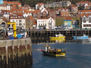
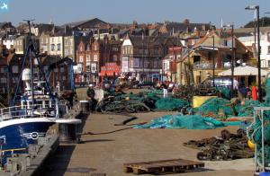
EAW007953 ENGLAND (1947). South Bay and the headland, Scarborough, from the south-west, 1947
© Copyright OpenStreetMap contributors and licensed by the OpenStreetMap Foundation. 2024. Cartography is licensed as CC BY-SA.
Nearby Images (9)
Details
| Title | [EAW007953] South Bay and the headland, Scarborough, from the south-west, 1947 |
| Reference | EAW007953 |
| Date | 26-June-1947 |
| Link | |
| Place name | SCARBOROUGH |
| Parish | |
| District | |
| Country | ENGLAND |
| Easting / Northing | 504427, 488294 |
| Longitude / Latitude | -0.39591730889832, 54.279446868071 |
| National Grid Reference | TA044883 |
Pins
 redmist |
Thursday 12th of September 2019 08:27:09 PM | |
 redmist |
Thursday 12th of September 2019 08:43:38 AM | |
 Brigham |
Thursday 23rd of July 2015 04:43:12 PM | |
 Brigham |
Thursday 23rd of July 2015 04:41:58 PM | |
 Brigham |
Thursday 23rd of July 2015 11:12:27 AM | |
 Alan McFaden |
Thursday 9th of January 2014 11:36:44 AM | |
 Alan McFaden |
Thursday 9th of January 2014 11:36:22 AM | |
The original lighthouse was seriously damaged by shells from German battlecruisers, SMS Derfflinger and SMS Von der Tann, when the town was bombarded on the morning of 16th December 1914. It was rebuilt in 1931. |
Lynda Tubbs |
Tuesday 18th of March 2014 12:25:09 PM |
 Alan McFaden |
Thursday 9th of January 2014 11:35:55 AM | |
 Alan McFaden |
Thursday 9th of January 2014 11:35:31 AM |


![[EAW007953] South Bay and the headland, Scarborough, from the south-west, 1947](http://britainfromabove.org.uk/sites/all/libraries/aerofilms-images/public/100x100/EAW/007/EAW007953.jpg)
![[EPW038932] The Grand Hotel, Rotunda Museum and St Nicholas Cliff, Scarborough, 1932](http://britainfromabove.org.uk/sites/all/libraries/aerofilms-images/public/100x100/EPW/038/EPW038932.jpg)
![[EAW016693] South Bay Beach, Scarborough, 1948](http://britainfromabove.org.uk/sites/all/libraries/aerofilms-images/public/100x100/EAW/016/EAW016693.jpg)
![[EAW007942] South Bay and the headland, Scarborough, from the south-west, 1947](http://britainfromabove.org.uk/sites/all/libraries/aerofilms-images/public/100x100/EAW/007/EAW007942.jpg)
![[EAW007954] South Bay and the headland, Scarborough, from the south-west, 1947](http://britainfromabove.org.uk/sites/all/libraries/aerofilms-images/public/100x100/EAW/007/EAW007954.jpg)
![[EPW038931] Foreshore Road and The Grand Hotel, Scarborough, from the south-east, 1932](http://britainfromabove.org.uk/sites/all/libraries/aerofilms-images/public/100x100/EPW/038/EPW038931.jpg)
![[EPW018342] South Sands, St Nicholas Cliff and environs, Scarborough, 1927. This image has been produced from a copy-negative.](http://britainfromabove.org.uk/sites/all/libraries/aerofilms-images/public/100x100/EPW/018/EPW018342.jpg)
![[EAW007945] South Cliff and Wheatcroft, Scarborough, from the north, 1947](http://britainfromabove.org.uk/sites/all/libraries/aerofilms-images/public/100x100/EAW/007/EAW007945.jpg)
![[EAW007947] The town centre, South Bay and the headland, Scarborough, from the south, 1947](http://britainfromabove.org.uk/sites/all/libraries/aerofilms-images/public/100x100/EAW/007/EAW007947.jpg)


