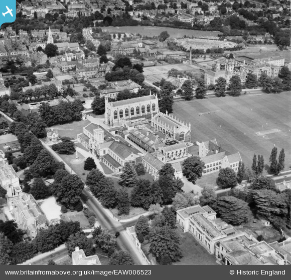
EAW006523 ENGLAND (1947). Cheltenham College, Cheltenham, 1947
© Copyright OpenStreetMap contributors and licensed by the OpenStreetMap Foundation. 2024. Cartography is licensed as CC BY-SA.
Nearby Images (13)
Details
| Title | [EAW006523] Cheltenham College, Cheltenham, 1947 |
| Reference | EAW006523 |
| Date | 31-May-1947 |
| Link | |
| Place name | CHELTENHAM |
| Parish | |
| District | |
| Country | ENGLAND |
| Easting / Northing | 394896, 221499 |
| Longitude / Latitude | -2.0741756426267, 51.891582609382 |
| National Grid Reference | SO949215 |
Pins
 Iain |
Monday 20th of January 2014 12:15:58 PM |


![[EAW006523] Cheltenham College, Cheltenham, 1947](http://britainfromabove.org.uk/sites/all/libraries/aerofilms-images/public/100x100/EAW/006/EAW006523.jpg)
![[EPW024138] Cheltenham College, Cheltenham, 1928](http://britainfromabove.org.uk/sites/all/libraries/aerofilms-images/public/100x100/EPW/024/EPW024138.jpg)
![[EPW000175] Cheltenham College, Cheltenham, 1920](http://britainfromabove.org.uk/sites/all/libraries/aerofilms-images/public/100x100/EPW/000/EPW000175.jpg)
![[EPW000174] Cheltenham College, Cheltenham, 1920](http://britainfromabove.org.uk/sites/all/libraries/aerofilms-images/public/100x100/EPW/000/EPW000174.jpg)
![[EPW000178] Cheltenham College, Cheltenham, 1920](http://britainfromabove.org.uk/sites/all/libraries/aerofilms-images/public/100x100/EPW/000/EPW000178.jpg)
![[EPW048208] Cheltenham College and the town, Cheltenham, 1935](http://britainfromabove.org.uk/sites/all/libraries/aerofilms-images/public/100x100/EPW/048/EPW048208.jpg)
![[EPW048207] Cheltenham College and the town, Cheltenham, 1935](http://britainfromabove.org.uk/sites/all/libraries/aerofilms-images/public/100x100/EPW/048/EPW048207.jpg)
![[EAW006516] Cheltenham College and Playing Fields, Cheltenham, 1947](http://britainfromabove.org.uk/sites/all/libraries/aerofilms-images/public/100x100/EAW/006/EAW006516.jpg)
![[EPW024139] Cheltenham College, Cheltenham, 1928](http://britainfromabove.org.uk/sites/all/libraries/aerofilms-images/public/100x100/EPW/024/EPW024139.jpg)
![[EPW024137] Cheltenham College, Cheltenham, 1928](http://britainfromabove.org.uk/sites/all/libraries/aerofilms-images/public/100x100/EPW/024/EPW024137.jpg)
![[EAW006515] Cheltenham College and Playing Fields, Cheltenham, 1947](http://britainfromabove.org.uk/sites/all/libraries/aerofilms-images/public/100x100/EAW/006/EAW006515.jpg)
![[EPR000385] Cheltenham College, Cheltenham, 1934. This image was marked by Aero Pictorial Ltd for photo editing.](http://britainfromabove.org.uk/sites/all/libraries/aerofilms-images/public/100x100/EPR/000/EPR000385.jpg)
![[EPW024134] Montpellier and Fairview, Cheltenham, from the south-west, 1928](http://britainfromabove.org.uk/sites/all/libraries/aerofilms-images/public/100x100/EPW/024/EPW024134.jpg)
