
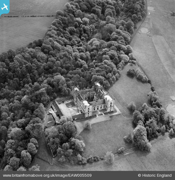
EAW005509 ENGLAND (1947). Lumley Castle, Lumley Castle, 1947
© Copyright OpenStreetMap contributors and licensed by the OpenStreetMap Foundation. 2024. Cartography is licensed as CC BY-SA.
Nearby Images (9)
EAW005509

EAW005511

EAW005508

EAW005510

EAW014486

EAW005507

EAW014487

EAW005506

EAW014488

Details
| Title | [EAW005509] Lumley Castle, Lumley Castle, 1947 |
| Reference | EAW005509 |
| Date | 15-May-1947 |
| Link | |
| Place name | LUMLEY CASTLE |
| Parish | LITTLE LUMLEY |
| District | |
| Country | ENGLAND |
| Easting / Northing | 428833, 551024 |
| Longitude / Latitude | -1.5508571550557, 54.853092938607 |
| National Grid Reference | NZ288510 |
Pins
Be the first to add a comment to this image!