
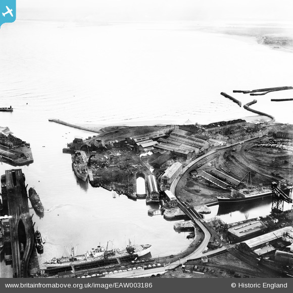
EAW003186 ENGLAND (1946). The Old Harbour, the Hartlepool Engine Works and Hartlepool Bay, Hartlepool, from the north-west, 1946
© Copyright OpenStreetMap contributors and licensed by the OpenStreetMap Foundation. 2025. Cartography is licensed as CC BY-SA.
Nearby Images (12)
EAW003186

EAW003191

EAW003185

EAW003192

EPW054633

EPW054634

EAW003203

EPW054635

EAW003187

EAW003190

EPW010608

EAW007972

Details
| Title | [EAW003186] The Old Harbour, the Hartlepool Engine Works and Hartlepool Bay, Hartlepool, from the north-west, 1946 |
| Reference | EAW003186 |
| Date | 23-October-1946 |
| Link | |
| Place name | HARTLEPOOL |
| Parish | |
| District | |
| Country | ENGLAND |
| Easting / Northing | 451998, 533936 |
| Longitude / Latitude | -1.1931001652732, 54.697658458635 |
| National Grid Reference | NZ520339 |
Pins
 redmist |
Friday 30th of September 2022 01:55:26 PM | |
redmist |
Friday 30th of September 2022 01:51:22 PM | |
redmist |
Saturday 26th of October 2019 10:24:13 PM |