
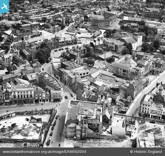
EAW002004 ENGLAND (1946). The Norwich Union offices on Surrey Street and environs, Norwich, 1946
© Copyright OpenStreetMap contributors and licensed by the OpenStreetMap Foundation. 2025. Cartography is licensed as CC BY-SA.
Nearby Images (17)
EAW002004

EAW001998

EAW002003

EAW001992

EAW001991

EAW002001

EAW001994

EAW001993

EAW001996

EAW001999

EAW001995

EAW002000

EAW002002

EPW001970A

EAW001997

EAW037292

EPW001766

Details
| Title | [EAW002004] The Norwich Union offices on Surrey Street and environs, Norwich, 1946 |
| Reference | EAW002004 |
| Date | 25-July-1946 |
| Link | |
| Place name | NORWICH |
| Parish | |
| District | |
| Country | ENGLAND |
| Easting / Northing | 623061, 308197 |
| Longitude / Latitude | 1.2961279898147, 52.625270481054 |
| National Grid Reference | TG231082 |
Pins
 Chris Lambert |
Thursday 25th of August 2016 01:54:00 PM | |
Chris Lambert |
Sunday 2nd of August 2015 08:21:40 AM | |
Chris Lambert |
Sunday 5th of April 2015 06:29:46 PM | |
Chris Lambert |
Sunday 5th of April 2015 06:29:03 PM | |
Chris Lambert |
Sunday 5th of April 2015 06:26:55 PM |