
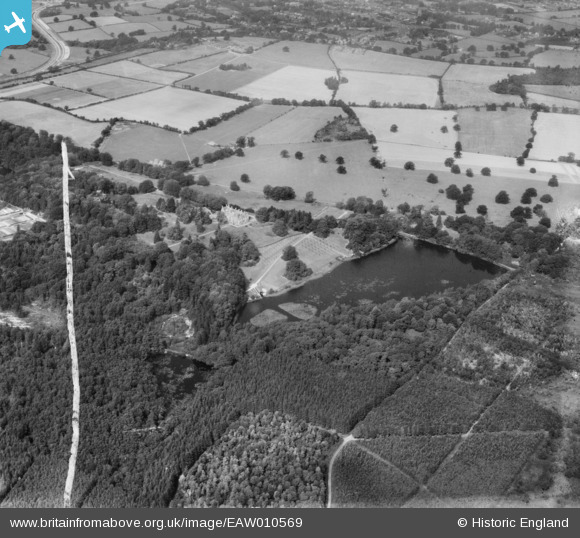
EAW010569 ENGLAND (1947). Tilgate Lake (Campbell's Lake) and surrounding forest and countryside, Tilgate, 1947. This image was marked by Aerofilms Ltd for photo editing.
© Hawlfraint cyfranwyr OpenStreetMap a thrwyddedwyd gan yr OpenStreetMap Foundation. 2024. Trwyddedir y gartograffeg fel CC BY-SA.
Manylion
| Pennawd | [EAW010569] Tilgate Lake (Campbell's Lake) and surrounding forest and countryside, Tilgate, 1947. This image was marked by Aerofilms Ltd for photo editing. |
| Cyfeirnod | EAW010569 |
| Dyddiad | 3-September-1947 |
| Dolen | |
| Enw lle | TILGATE |
| Plwyf | |
| Ardal | |
| Gwlad | ENGLAND |
| Dwyreiniad / Gogleddiad | 527740, 134491 |
| Hydred / Lledred | -0.1755879869078, 51.094950942495 |
| Cyfeirnod Grid Cenedlaethol | TQ277345 |
Pinnau
 Bob |
Friday 15th of October 2021 12:08:35 AM | |
Bob |
Friday 15th of October 2021 12:07:04 AM | |
Bob |
Friday 15th of October 2021 12:05:02 AM | |
tholl17 |
Sunday 6th of July 2014 06:50:04 PM | |
 Maurice |
Friday 28th of March 2014 04:26:49 PM |
Cyfraniadau Grŵp
I thought this might be a hammer pond associated with the Wealden iron industry, but it may not be: 'Tilgate Furnace Pond now lies beneath the suburb of Furnace Green, south of Crawley. Dozens of hammer and furnace ponds have survived, however, especially in the High Wealden area of Sussex' Source - www.hammerpond.org.uk/History/history.htm |
MB |
Friday 28th of March 2014 05:43:52 PM |