
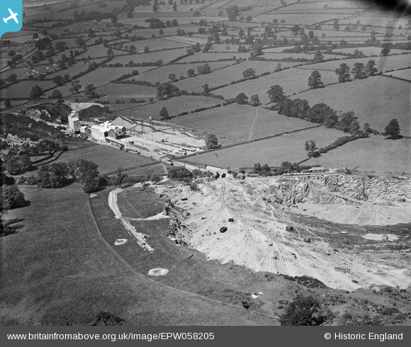
epw058205 ENGLAND (1938). Quarry at The Warren and adjoining Quarry Works at Froane's Hill, Enderby, 1938
© Copyright OpenStreetMap contributors and licensed by the OpenStreetMap Foundation. 2026. Cartography is licensed as CC BY-SA.
Nearby Images (10)
EPW058205

EPW058204

EPW058199

EPW058203

EPW058207

EPW058200

EPW058206

EPW058202

EPW058201

EPW058198

Details
| Title | [EPW058205] Quarry at The Warren and adjoining Quarry Works at Froane's Hill, Enderby, 1938 |
| Reference | EPW058205 |
| Date | 20-July-1938 |
| Link | |
| Place name | ENDERBY |
| Parish | ENDERBY |
| District | |
| Country | ENGLAND |
| Easting / Northing | 453646, 300093 |
| Longitude / Latitude | -1.2079270772929, 52.595625034299 |
| National Grid Reference | SK536001 |
Pins

thompson |
Monday 11th of May 2020 03:31:33 PM | |
|
thompson |
Monday 11th of May 2020 03:30:58 PM | |
|
MB |
Thursday 20th of June 2013 09:55:56 PM | |
|
MB |
Thursday 20th of June 2013 09:55:04 PM | |
|
MB |
Thursday 20th of June 2013 09:54:24 PM |