
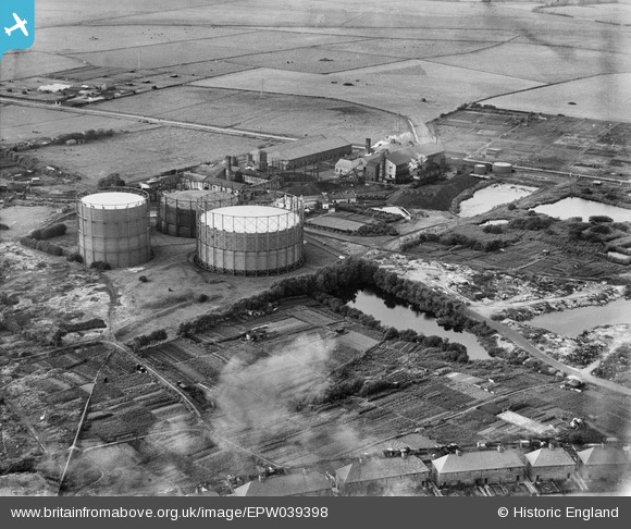
epw039398 ENGLAND (1932). The Eastbourne Gas Co Works, Eastbourne, 1932
© Copyright OpenStreetMap contributors and licensed by the OpenStreetMap Foundation. 2025. Cartography is licensed as CC BY-SA.
Nearby Images (8)
EPW039398

EPW039417

EPW039397

EPW039402

EPW039400

EPW039418

EPW039401

EPW039399

Details
| Title | [EPW039398] The Eastbourne Gas Co Works, Eastbourne, 1932 |
| Reference | EPW039398 |
| Date | August-1932 |
| Link | |
| Place name | EASTBOURNE |
| Parish | |
| District | |
| Country | ENGLAND |
| Easting / Northing | 562306, 101012 |
| Longitude / Latitude | 0.30279102812127, 50.785364979734 |
| National Grid Reference | TQ623010 |
Pins
 DLB |
Tuesday 25th of June 2013 03:42:35 PM | |
DLB |
Tuesday 25th of June 2013 03:40:23 PM | |
DLB |
Tuesday 25th of June 2013 03:37:59 PM |