
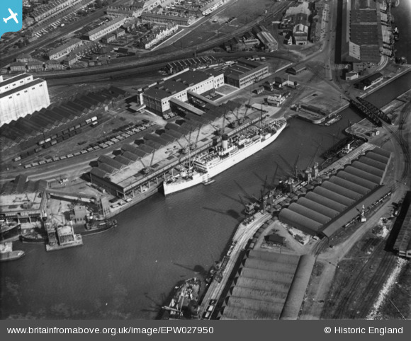
epw027950 ENGLAND (1929). Avonmouth Docks, Avonmouth, 1929. This image has been produced from a print.
© Copyright OpenStreetMap contributors and licensed by the OpenStreetMap Foundation. 2024. Cartography is licensed as CC BY-SA.
Nearby Images (18)
EPW027950

EPW005529

EPW005530

EAW002061

EAW002243

EPW046969

EPW019269

EPW046968

EPW008648

EPW005537

EPW005533

EAW002056

EAW002070

EPW005517

EPW043047

EPW044780

EPW044776

EPW043046

Details
| Title | [EPW027950] Avonmouth Docks, Avonmouth, 1929. This image has been produced from a print. |
| Reference | EPW027950 |
| Date | June-1929 |
| Link | |
| Place name | AVONMOUTH |
| Parish | |
| District | |
| Country | ENGLAND |
| Easting / Northing | 351088, 178376 |
| Longitude / Latitude | -2.7047526280741, 51.501718073282 |
| National Grid Reference | ST511784 |
Pins
Be the first to add a comment to this image!