
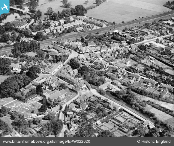
epw022620 ENGLAND (1928). The village centre, Pangbourne, 1928
© Copyright OpenStreetMap contributors and licensed by the OpenStreetMap Foundation. 2026. Cartography is licensed as CC BY-SA.
Nearby Images (3)
EPW022620

EPW022677

EPW022512

Details
| Title | [EPW022620] The village centre, Pangbourne, 1928 |
| Reference | EPW022620 |
| Date | 15-August-1928 |
| Link | |
| Place name | PANGBOURNE |
| Parish | PANGBOURNE |
| District | |
| Country | ENGLAND |
| Easting / Northing | 463518, 176464 |
| Longitude / Latitude | -1.0851653438815, 51.483073480047 |
| National Grid Reference | SU635765 |
Pins

Dennis Jackson |
Monday 11th of March 2013 04:46:04 AM | |
|
Norman W |
Sunday 30th of September 2012 11:58:27 AM | |
|
Norman W |
Sunday 30th of September 2012 11:54:59 AM | |
|
Norman W |
Sunday 30th of September 2012 11:25:47 AM | |
|
Norman W |
Sunday 30th of September 2012 11:24:10 AM | |
|
Norman W |
Sunday 30th of September 2012 11:17:01 AM | |
|
Norman W |
Sunday 30th of September 2012 11:15:38 AM |