
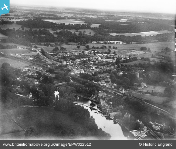
EPW022512 ENGLAND (1928). The town and railway, Pangbourne, from the north-west, 1928
© Copyright OpenStreetMap contributors and licensed by the OpenStreetMap Foundation. 2026. Cartography is licensed as CC BY-SA.
Nearby Images (3)
EPW022512

EPW022514

EPW022620

Details
| Title | [EPW022512] The town and railway, Pangbourne, from the north-west, 1928 |
| Reference | EPW022512 |
| Date | 11-August-1928 |
| Link | |
| Place name | PANGBOURNE |
| Parish | PANGBOURNE |
| District | |
| Country | ENGLAND |
| Easting / Northing | 463376, 176702 |
| Longitude / Latitude | -1.0871675281873, 51.485229364785 |
| National Grid Reference | SU634767 |
Pins
Be the first to add a comment to this image!