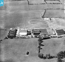
epw022048 ENGLAND (1928). Stag Lane Aerodrome, Queensbury, 1928
© Copyright OpenStreetMap contributors and licensed by the OpenStreetMap Foundation. 2024. Cartography is licensed as CC BY-SA.
Nearby Images (48)
Details
| Title | [EPW022048] Stag Lane Aerodrome, Queensbury, 1928 |
| Reference | EPW022048 |
| Date | July-1928 |
| Link | |
| Place name | QUEENSBURY |
| Parish | |
| District | |
| Country | ENGLAND |
| Easting / Northing | 519576, 190106 |
| Longitude / Latitude | -0.27344121464451, 51.596618424863 |
| National Grid Reference | TQ196901 |
Pins
Be the first to add a comment to this image!
User Comment Contributions
Could be Stag Lane |
 Peanut |
Wednesday 26th of March 2014 11:46:34 AM |
Definitely Stag Lane with Dehavilland factory - from south |
 Sydney Paul |
Wednesday 26th of March 2014 11:46:34 AM |
Dear all, That's great; we've reviewed your suggestions and thanks to your help we can update the catalogue. The revised record will appear here in due course. Hope you have the same success solving some of our other mysteries! Katy Whitaker Britain from Above Cataloguer |
Katy Whitaker |
Monday 2nd of July 2012 11:41:43 AM |
I agree, think Stag Lane is a good bet for this one so I've put a pin on the map. |
 Whittocks |
Sunday 1st of July 2012 01:20:42 PM |
 BigglesH |
Thursday 28th of June 2012 01:42:49 PM | |
An Airfield (you can see the planes). Surprisingly active. Manufacturing site ? |
 BigglesH |
Tuesday 26th of June 2012 09:51:30 PM |


![[EPW022048] Stag Lane Aerodrome, Queensbury, 1928](http://britainfromabove.org.uk/sites/all/libraries/aerofilms-images/public/100x100/EPW/022/EPW022048.jpg)
![[EPW047553] The former works of De Havilland at Stag Lane and surrounding housing development, Queensbury, 1935](http://britainfromabove.org.uk/sites/all/libraries/aerofilms-images/public/100x100/EPW/047/EPW047553.jpg)
![[EPW032889] The de Havilland Works at Stag Lane Aerodrome, Queensbury, 1930](http://britainfromabove.org.uk/sites/all/libraries/aerofilms-images/public/100x100/EPW/032/EPW032889.jpg)
![[EPW047550] The former works of De Havilland at Stag Lane and construction of new housing at Beverley Drive, Queensbury, 1935](http://britainfromabove.org.uk/sites/all/libraries/aerofilms-images/public/100x100/EPW/047/EPW047550.jpg)
![[EPW009129] The De Havillands Works at the Stag Lane Aerodrome, Queensbury, 1923. This image has been produced from a copy-negative.](http://britainfromabove.org.uk/sites/all/libraries/aerofilms-images/public/100x100/EPW/009/EPW009129.jpg)
![[EPW013198] Stag Lane Aerodrome, Edgware, 1925](http://britainfromabove.org.uk/sites/all/libraries/aerofilms-images/public/100x100/EPW/013/EPW013198.jpg)
![[EPW047556] The former works of De Havilland at Stag Lane and surrounding housing development, Queensbury, 1935](http://britainfromabove.org.uk/sites/all/libraries/aerofilms-images/public/100x100/EPW/047/EPW047556.jpg)
![[EPW013196] Stag Lane Aerodrome, Edgware, 1925](http://britainfromabove.org.uk/sites/all/libraries/aerofilms-images/public/100x100/EPW/013/EPW013196.jpg)
![[EPW032892] The de Havilland Works at Stag Lane Aerodrome, Queensbury, 1930](http://britainfromabove.org.uk/sites/all/libraries/aerofilms-images/public/100x100/EPW/032/EPW032892.jpg)
![[EPW032890] The de Havilland Works at Stag Lane Aerodrome, Queensbury, 1930](http://britainfromabove.org.uk/sites/all/libraries/aerofilms-images/public/100x100/EPW/032/EPW032890.jpg)
![[EPW046486] Housing estate under construction at the site of Stag Lane Aerodrome, Queensbury, from the south, 1935](http://britainfromabove.org.uk/sites/all/libraries/aerofilms-images/public/100x100/EPW/046/EPW046486.jpg)
![[EPW034987] Stag Lane Aerodrome, Queensbury, from the west, 1931](http://britainfromabove.org.uk/sites/all/libraries/aerofilms-images/public/100x100/EPW/034/EPW034987.jpg)
![[EPW046489] Housing estate under construction at the site of Stag Lane Aerodrome, Queensbury, from the south-west, 1935](http://britainfromabove.org.uk/sites/all/libraries/aerofilms-images/public/100x100/EPW/046/EPW046489.jpg)
![[EPW031547] Stag Lane Aerodrome and surroundings, Little Stanmore, from the south-west, 1930](http://britainfromabove.org.uk/sites/all/libraries/aerofilms-images/public/100x100/EPW/031/EPW031547.jpg)
![[EPW047557] The former works of De Havilland at Stag Lane, Queensbury, 1935](http://britainfromabove.org.uk/sites/all/libraries/aerofilms-images/public/100x100/EPW/047/EPW047557.jpg)
![[EPW047554] The former works of De Havilland at Stag Lane, Queensbury, 1935](http://britainfromabove.org.uk/sites/all/libraries/aerofilms-images/public/100x100/EPW/047/EPW047554.jpg)
![[EPW034797] Stag Lane Aerodrome and environs, Little Stanmore, from the south-east, 1931. This image has been produced from a damaged negative.](http://britainfromabove.org.uk/sites/all/libraries/aerofilms-images/public/100x100/EPW/034/EPW034797.jpg)
![[EPW046490] Housing estate under construction at the site of Stag Lane Aerodrome, Queensbury, from the south-west, 1935](http://britainfromabove.org.uk/sites/all/libraries/aerofilms-images/public/100x100/EPW/046/EPW046490.jpg)
![[EPW047552] The former works of De Havilland at Stag Lane and surrounding housing development, Queensbury, 1935](http://britainfromabove.org.uk/sites/all/libraries/aerofilms-images/public/100x100/EPW/047/EPW047552.jpg)
![[EPW018765] Construction of the Watling Estate, Queensbury, from the south-west, 1927](http://britainfromabove.org.uk/sites/all/libraries/aerofilms-images/public/100x100/EPW/018/EPW018765.jpg)
![[EPW022364] Stag Lane Aerodrome, Little Stanmore, 1928](http://britainfromabove.org.uk/sites/all/libraries/aerofilms-images/public/100x100/EPW/022/EPW022364.jpg)
![[EPW047549] The former works of De Havilland at Stag Lane and housing at Holyrood Gardens and De Havilland Road, Queensbury, 1935](http://britainfromabove.org.uk/sites/all/libraries/aerofilms-images/public/100x100/EPW/047/EPW047549.jpg)
![[EPW025073] Stag Lane Aerodrome, Edgware, 1928. This image has been produced from a copy-negative.](http://britainfromabove.org.uk/sites/all/libraries/aerofilms-images/public/100x100/EPW/025/EPW025073.jpg)
![[EPW025074] Stag Lane Aerodrome, Edgware, 1928. This image has been produced from a copy-negative.](http://britainfromabove.org.uk/sites/all/libraries/aerofilms-images/public/100x100/EPW/025/EPW025074.jpg)
![[EPW030058] Little Stanmore, Sir Alan Cobham finishes his 21 weeks' flying tour of Britain at Stag Lane Aerodrome, 1929](http://britainfromabove.org.uk/sites/all/libraries/aerofilms-images/public/100x100/EPW/030/EPW030058.jpg)
![[EPW030057] Little Stanmore, Sir Alan Cobham finishes his 21 weeks' flying tour of Britain at Stag Lane Aerodrome, 1929](http://britainfromabove.org.uk/sites/all/libraries/aerofilms-images/public/100x100/EPW/030/EPW030057.jpg)
![[EPW034980] Stag Lane Aerodrome and environs, Queensbury, from the north-west, 1931](http://britainfromabove.org.uk/sites/all/libraries/aerofilms-images/public/100x100/EPW/034/EPW034980.jpg)
![[EPW046487] Housing estate under construction at the site of Stag Lane Aerodrome, Queensbury, from the south, 1935](http://britainfromabove.org.uk/sites/all/libraries/aerofilms-images/public/100x100/EPW/046/EPW046487.jpg)
![[EPW017872] Queensbury, DH60 Moth G-EBOH undergoing flight trials at the De Havilland Stag Lane Aerodrome, 1927](http://britainfromabove.org.uk/sites/all/libraries/aerofilms-images/public/100x100/EPW/017/EPW017872.jpg)
![[EPW017873] Queensbury, DH60 Moth G-EBOH undergoing flight trials at the De Havilland Stag Lane Aerodrome, 1927](http://britainfromabove.org.uk/sites/all/libraries/aerofilms-images/public/100x100/EPW/017/EPW017873.jpg)
![[EPW017874] Queensbury, DH60 Moth G-EBOH undergoing flight trials at the De Havilland Stag Lane Aerodrome, 1927](http://britainfromabove.org.uk/sites/all/libraries/aerofilms-images/public/100x100/EPW/017/EPW017874.jpg)
![[EPW017875] Queensbury, DH60 Moth G-EBOH undergoing flight trials at the De Havilland Stag Lane Aerodrome, 1927](http://britainfromabove.org.uk/sites/all/libraries/aerofilms-images/public/100x100/EPW/017/EPW017875.jpg)
![[EPW017876] Queensbury, DH60 Moth G-EBOH undergoing flight trials at the De Havilland Stag Lane Aerodrome, 1927](http://britainfromabove.org.uk/sites/all/libraries/aerofilms-images/public/100x100/EPW/017/EPW017876.jpg)
![[EPW017877] Queensbury, DH60 Moth G-EBOH undergoing flight trials at the De Havilland Stag Lane Aerodrome, 1927](http://britainfromabove.org.uk/sites/all/libraries/aerofilms-images/public/100x100/EPW/017/EPW017877.jpg)
![[EPW017878] Queensbury, DH60 Moth G-EBOH undergoing flight trials at the De Havilland Stag Lane Aerodrome, 1927](http://britainfromabove.org.uk/sites/all/libraries/aerofilms-images/public/100x100/EPW/017/EPW017878.jpg)
![[EPW017880] Queensbury, DH60 Moth G-EBOH undergoing flight trials at the De Havilland Stag Lane Aerodrome, 1927](http://britainfromabove.org.uk/sites/all/libraries/aerofilms-images/public/100x100/EPW/017/EPW017880.jpg)
![[EPW018132] Stag Lane Aerodrome, Queensbury, from the south-east, 1927. This image has been produced from a copy-negative.](http://britainfromabove.org.uk/sites/all/libraries/aerofilms-images/public/100x100/EPW/018/EPW018132.jpg)
![[EPW034981] Stag Lane Aerodrome and environs, Little Stanmore, from the north-west, 1931](http://britainfromabove.org.uk/sites/all/libraries/aerofilms-images/public/100x100/EPW/034/EPW034981.jpg)
![[EPW018148] Twenty DH.60 Moths parked at Stag Lane Aerodrome, Little Stanmore, 1927. This image has been produced from a copy-negative.](http://britainfromabove.org.uk/sites/all/libraries/aerofilms-images/public/100x100/EPW/018/EPW018148.jpg)
![[EPW046485] Housing estate under construction at the site of Stag Lane Aerodrome, Queensbury, from the south, 1935](http://britainfromabove.org.uk/sites/all/libraries/aerofilms-images/public/100x100/EPW/046/EPW046485.jpg)
![[EPW035010] Stag Lane Aerodrome and environs, Little Stanmore, from the south-east, 1931](http://britainfromabove.org.uk/sites/all/libraries/aerofilms-images/public/100x100/EPW/035/EPW035010.jpg)
![[EPW025691] Stag Lane Aerodrome, Little Stanmore, 1929](http://britainfromabove.org.uk/sites/all/libraries/aerofilms-images/public/100x100/EPW/025/EPW025691.jpg)
![[EPW030056] The Youth of Britain at Stag Lane Aerodrome following Sir Alan Cobham's tour of Britain, 1929](http://britainfromabove.org.uk/sites/all/libraries/aerofilms-images/public/100x100/EPW/030/EPW030056.jpg)
![[EPW035016] Stag Lane Aerodrome and environs, Queensbury, from the south-east, 1931](http://britainfromabove.org.uk/sites/all/libraries/aerofilms-images/public/100x100/EPW/035/EPW035016.jpg)
![[EPW031582] Stag Lane Aerodrome, Little Stanmore, from the south-east, 1930](http://britainfromabove.org.uk/sites/all/libraries/aerofilms-images/public/100x100/EPW/031/EPW031582.jpg)
![[EPW031546] Stag Lane Aerodrome and surroundings, Little Stanmore, from the south, 1930](http://britainfromabove.org.uk/sites/all/libraries/aerofilms-images/public/100x100/EPW/031/EPW031546.jpg)
