
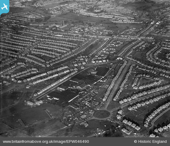
EPW046490 ENGLAND (1935). Housing estate under construction at the site of Stag Lane Aerodrome, Queensbury, from the south-west, 1935
© Copyright OpenStreetMap contributors and licensed by the OpenStreetMap Foundation. 2026. Cartography is licensed as CC BY-SA.
Nearby Images (48)
EPW046490

EPW046486

EPW047552

EPW013198

EPW009129

EPW047550

EPW018765

EPW046488

EPW047556

EPW032890

EPW032889

EPW034980

EPW034980
EPW013196

EPW017872

EPW017873

EPW017874

EPW017875

EPW017876

EPW017877

EPW017878

EPW017880

EPW022048

EPW047554

EPW047549

EPW047553

EPW047557

EPW032892

EPW018132

EPW046485

EPW034987

EPW046489

EPW046487

EPW034797

EPW031547

EPW022364

EPW025073

EPW035016

EPW030057

EPW030058

EPW025074

EPW025691

EPW035010

EPW034981

EPW034981
EPW018148

EPW035014

EPW030056

Details
| Title | [EPW046490] Housing estate under construction at the site of Stag Lane Aerodrome, Queensbury, from the south-west, 1935 |
| Reference | EPW046490 |
| Date | January-1935 |
| Link | |
| Place name | QUEENSBURY |
| Parish | |
| District | |
| Country | ENGLAND |
| Easting / Northing | 519627, 190052 |
| Longitude / Latitude | -0.27272360226079, 51.596122227664 |
| National Grid Reference | TQ196901 |
Pins

stevenprice |
Monday 8th of February 2021 05:30:46 PM |