
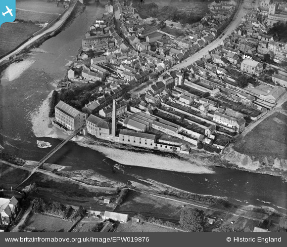
epw019876 ENGLAND (1927). Thorngate Mills and Thorngate Bridge, Barnard Castle, 1927
© Copyright OpenStreetMap contributors and licensed by the OpenStreetMap Foundation. 2026. Cartography is licensed as CC BY-SA.
Details
| Title | [EPW019876] Thorngate Mills and Thorngate Bridge, Barnard Castle, 1927 |
| Reference | EPW019876 |
| Date | October-1927 |
| Link | |
| Place name | BARNARD CASTLE |
| Parish | BARNARD CASTLE |
| District | |
| Country | ENGLAND |
| Easting / Northing | 404950, 516018 |
| Longitude / Latitude | -1.9234849568537, 54.539276888567 |
| National Grid Reference | NZ050160 |
Pins

Geordie |
Saturday 10th of October 2015 09:17:48 PM | |
 |
Geordie |
Saturday 10th of October 2015 11:27:36 AM |
|
Geordie |
Saturday 10th of October 2015 11:21:32 AM | |
|
Geordie |
Saturday 10th of October 2015 11:20:00 AM | |
 |

Class31 |
Thursday 15th of May 2014 06:12:12 PM |
|
Class31 |
Saturday 19th of January 2013 04:45:22 PM | |
|
Class31 |
Saturday 19th of January 2013 04:43:14 PM | |
|
Class31 |
Saturday 19th of January 2013 04:42:43 PM | |
|
Class31 |
Saturday 19th of January 2013 04:42:15 PM | |
|
Class31 |
Saturday 19th of January 2013 04:41:34 PM | |
|
Class31 |
Saturday 19th of January 2013 04:41:11 PM | |
|
Class31 |
Saturday 19th of January 2013 04:40:46 PM | |
|
Class31 |
Saturday 19th of January 2013 04:40:15 PM | |
|
Chells809 |
Friday 21st of December 2012 09:32:52 PM |
User Comment Contributions
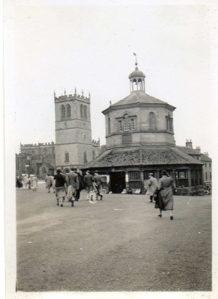
Butter Market and St. Mary's Church, Barnard Castle , June or July 1939 |
Class31 |
Monday 29th of September 2014 10:59:39 PM |