
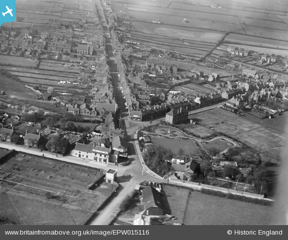
epw015116 ENGLAND (1926). The High Street and War Memorial Park, Chasetown, 1926
© Copyright OpenStreetMap contributors and licensed by the OpenStreetMap Foundation. 2025. Cartography is licensed as CC BY-SA.
Nearby Images (2)
EPW015116

EPW015117

Details
| Title | [EPW015116] The High Street and War Memorial Park, Chasetown, 1926 |
| Reference | EPW015116 |
| Date | 12-April-1926 |
| Link | |
| Place name | CHASETOWN |
| Parish | BURNTWOOD |
| District | |
| Country | ENGLAND |
| Easting / Northing | 404566, 308080 |
| Longitude / Latitude | -1.9324699323887, 52.670063501387 |
| National Grid Reference | SK046081 |
Pins
 areed |
Monday 4th of January 2021 04:08:31 PM | |
areed |
Monday 4th of January 2021 04:06:32 PM | |
areed |
Thursday 23rd of April 2020 08:59:56 PM | |
areed |
Thursday 23rd of April 2020 08:59:15 PM | |
areed |
Thursday 23rd of April 2020 08:57:20 PM | |
areed |
Thursday 23rd of April 2020 08:55:31 PM | |
KevTheBusDriver |
Sunday 2nd of February 2014 06:42:27 PM |
User Comment Contributions
mine and my grandmothers birth place gran in 1895 mine in 1950 my gran born over the road from the large building almost in the middle of the photo it's a mining collage as Chasetown was a mining vllage until the 1960's. |
caz |
Thursday 20th of September 2012 03:06:59 PM |