
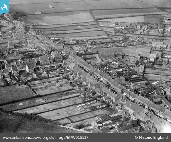
EPW015117 ENGLAND (1926). The High Street, Chasetown, 1926
© Copyright OpenStreetMap contributors and licensed by the OpenStreetMap Foundation. 2026. Cartography is licensed as CC BY-SA.
Nearby Images (3)
EPW015117

EPW015116

EPW015118

Details
| Title | [EPW015117] The High Street, Chasetown, 1926 |
| Reference | EPW015117 |
| Date | 12-April-1926 |
| Link | |
| Place name | CHASETOWN |
| Parish | BURNTWOOD |
| District | |
| Country | ENGLAND |
| Easting / Northing | 404560, 308230 |
| Longitude / Latitude | -1.9325565944413, 52.671412158577 |
| National Grid Reference | SK046082 |
Pins

areed |
Monday 4th of January 2021 04:11:22 PM |