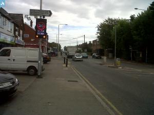
epw006293 ENGLAND (1921). Rickmansworth Road and environs, Northwood, 1921
© Copyright OpenStreetMap contributors and licensed by the OpenStreetMap Foundation. 2024. Cartography is licensed as CC BY-SA.
Details
| Title | [EPW006293] Rickmansworth Road and environs, Northwood, 1921 |
| Reference | EPW006293 |
| Date | 23-May-1921 |
| Link | |
| Place name | NORTHWOOD |
| Parish | |
| District | |
| Country | ENGLAND |
| Easting / Northing | 509697, 190803 |
| Longitude / Latitude | -0.41580478676124, 51.6048946591 |
| National Grid Reference | TQ097908 |
Pins
 The Laird |
Sunday 24th of July 2016 11:16:32 AM | |
 Polar Bear |
Tuesday 26th of January 2016 07:02:04 PM | |
 Polar Bear |
Tuesday 26th of January 2016 07:00:51 PM | |
 The Laird |
Thursday 28th of May 2015 05:39:13 PM | |
 David and Marion |
Saturday 24th of August 2013 10:48:39 AM | |
 Andy Burland |
Wednesday 24th of July 2013 10:23:44 PM | |
 Andy Burland |
Wednesday 24th of July 2013 10:22:35 PM | |
 Class31 |
Thursday 20th of June 2013 02:01:26 PM | |
 LesMead |
Thursday 16th of May 2013 11:30:07 AM | |
 Class31 |
Monday 3rd of September 2012 07:11:54 AM | |
 Class31 |
Monday 3rd of September 2012 06:58:14 AM | |
Harry Neal & Co's yard |
 Stuart Johnson |
Wednesday 20th of March 2013 12:47:50 AM |
The temporary track appears to cross the Pinner Road and go well inside the Acre Way construction site, with tramways running off it. |
 The Laird |
Saturday 8th of February 2014 03:00:46 PM |
 Class31 |
Monday 3rd of September 2012 06:54:17 AM | |
 Class31 |
Sunday 2nd of September 2012 10:32:54 PM | |
 Class31 |
Sunday 2nd of September 2012 10:32:18 PM | |
 Class31 |
Sunday 2nd of September 2012 10:31:51 PM | |
 Class31 |
Sunday 2nd of September 2012 10:19:36 PM | |
 Keith |
Wednesday 11th of July 2012 01:35:59 PM |
User Comment Contributions
This shows the Rickmansworth Road taken from Northwood Hills Circus looking west. The railway bridge was the original which was replaced by the current Iron Bridge when the Metropolitan line was widened to 4 tracks in the early 1960's is beleive At the very bottom of the photo is the Cottage Hospital |
 Andy Burland |
Sunday 24th of July 2016 11:04:14 AM |
The cottage hospital isn't built yet, the building at the bottom is Hundred Acres Farm. The main road is Pinner Road as far as the High Street, and only becomes Rickmansworth Road beyond there. |
 Stuart Johnson |
Wednesday 20th of March 2013 12:46:04 AM |
According to the Wiki entry, Northwood & Pinner Cottage Hospital was opened by Lloyd-George's wife in 1920 as a war memorial. This is patently not the case, as the field in which the hospital was sited is empty and undeveloped, without even any signs of preliminary groundworks. |
 The Laird |
Sunday 24th of July 2016 11:04:14 AM |
 Northwood Iron Bridge 2012 |
 David and Marion |
Thursday 20th of February 2014 07:10:30 PM |


