
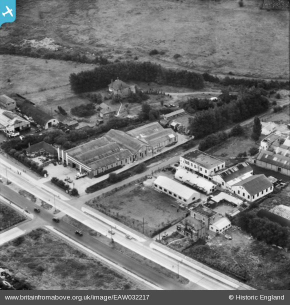
eaw032217 ENGLAND (1950). The Trebor Factory on Woodford Avenue, Clayhall, 1950
© Copyright OpenStreetMap contributors and licensed by the OpenStreetMap Foundation. 2026. Cartography is licensed as CC BY-SA.
Nearby Images (8)
EAW032217

EAW032218

EAW032215

EAW032214

EAW032213

EAW032220

EAW032216

EAW032219

Details
| Title | [EAW032217] The Trebor Factory on Woodford Avenue, Clayhall, 1950 |
| Reference | EAW032217 |
| Date | 4-September-1950 |
| Link | |
| Place name | CLAYHALL |
| Parish | |
| District | |
| Country | ENGLAND |
| Easting / Northing | 541864, 189944 |
| Longitude / Latitude | 0.048105893745126, 51.589989961542 |
| National Grid Reference | TQ419899 |
Pins

Mikeya |
Tuesday 30th of June 2020 08:09:34 PM | |
|
Mikeya |
Tuesday 30th of June 2020 08:09:01 PM | |
|
Mikeya |
Tuesday 30th of June 2020 08:08:39 PM | |
|
Mikeya |
Tuesday 30th of June 2020 08:08:19 PM | |
|
Mikeya |
Tuesday 30th of June 2020 08:07:37 PM |