
Scheduled Maintenance
This website will undergo scheduled maintenance on Tuesday, September 10th, between 11:00 and 15:00, as well as on Thursday, September 12th, between 10:00 and 12:00. During this time, services may be temporarily disrupted. We apologise for any inconvenience.
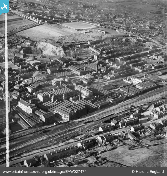
eaw027474 ENGLAND (1949). Woollen Mills surrounding Bradford Road East and the Batley Cricket, Athletic and Football Grounds, Batley, 1949. This image was marked by Aerofilms Ltd for photo editing.
© Copyright OpenStreetMap contributors and licensed by the OpenStreetMap Foundation. 2024. Cartography is licensed as CC BY-SA.
Nearby Images (12)
EAW027474

EAW027480

EAW027483

EAW027473

EAW027479

EAW027475

EAW027481

EAW027477

EAW027478

EAW027476

EAW027482

EAW027472

Details
| Title | [EAW027474] Woollen Mills surrounding Bradford Road East and the Batley Cricket, Athletic and Football Grounds, Batley, 1949. This image was marked by Aerofilms Ltd for photo editing. |
| Reference | EAW027474 |
| Date | 27-October-1949 |
| Link | |
| Place name | BATLEY |
| Parish | |
| District | |
| Country | ENGLAND |
| Easting / Northing | 424535, 423024 |
| Longitude / Latitude | -1.6283081234509, 53.702845303756 |
| National Grid Reference | SE245230 |
Pins
 trevpau |
Friday 6th of January 2023 07:40:18 PM | |
HOLMES |
Tuesday 29th of September 2015 12:53:09 PM | |
HOLMES |
Tuesday 29th of September 2015 12:51:39 PM | |
gerry-r |
Thursday 1st of January 2015 10:03:45 PM |