
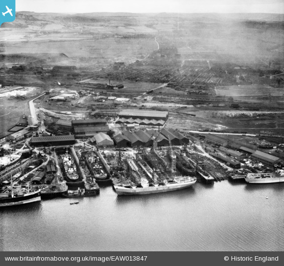
eaw013847 ENGLAND (1948). Smith's Dock Co Ltd Shipbuilding Yard at South Bank and environs, Dormanstown, from the north-west, 1948
© Copyright OpenStreetMap contributors and licensed by the OpenStreetMap Foundation. 2025. Cartography is licensed as CC BY-SA.
Nearby Images (5)
EAW013847

EAW013845

EAW013841

EAW013848

EAW013837

Details
| Title | [EAW013847] Smith's Dock Co Ltd Shipbuilding Yard at South Bank and environs, Dormanstown, from the north-west, 1948 |
| Reference | EAW013847 |
| Date | 16-March-1948 |
| Link | |
| Place name | DORMANSTOWN |
| Parish | |
| District | |
| Country | ENGLAND |
| Easting / Northing | 452699, 521842 |
| Longitude / Latitude | -1.1844020255923, 54.588898775645 |
| National Grid Reference | NZ527218 |
Pins
Be the first to add a comment to this image!