
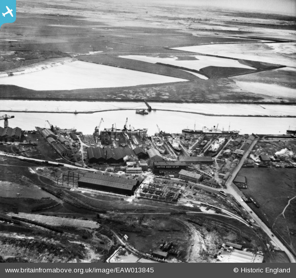
EAW013845 ENGLAND (1948). Smith's Dock Co Ltd Shipbuilding Yard at South Bank, Dormanstown, 1948
© Copyright OpenStreetMap contributors and licensed by the OpenStreetMap Foundation. 2026. Cartography is licensed as CC BY-SA.
Nearby Images (5)
EAW013845

EAW013847

EAW013841

EAW013837

EAW013848

Details
| Title | [EAW013845] Smith's Dock Co Ltd Shipbuilding Yard at South Bank, Dormanstown, 1948 |
| Reference | EAW013845 |
| Date | 16-March-1948 |
| Link | |
| Place name | DORMANSTOWN |
| Parish | |
| District | |
| Country | ENGLAND |
| Easting / Northing | 452743, 521862 |
| Longitude / Latitude | -1.1837175407619, 54.589073924185 |
| National Grid Reference | NZ527219 |
Pins

Class31 |
Tuesday 21st of January 2014 08:25:35 AM |