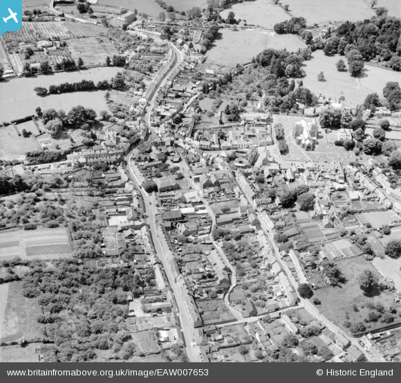
eaw007653 ENGLAND (1947). The town, Ottery St Mary, 1947
© Copyright OpenStreetMap contributors and licensed by the OpenStreetMap Foundation. 2024. Cartography is licensed as CC BY-SA.
Details
| Title | [EAW007653] The town, Ottery St Mary, 1947 |
| Reference | EAW007653 |
| Date | 17-June-1947 |
| Link | |
| Place name | OTTERY ST MARY |
| Parish | OTTERY ST. MARY |
| District | |
| Country | ENGLAND |
| Easting / Northing | 309951, 95463 |
| Longitude / Latitude | -3.2766338316399, 50.751204722766 |
| National Grid Reference | SY100955 |
Pins
 Charles Dale |
Thursday 18th of June 2020 07:20:07 PM | |
 Sparky |
Monday 9th of October 2017 09:27:28 AM | |
 MB |
Wednesday 7th of September 2016 08:26:23 PM | |
 MB |
Wednesday 7th of September 2016 08:25:29 PM | |
 MB |
Wednesday 7th of September 2016 08:24:59 PM | |
 Charles Dale |
Tuesday 7th of July 2015 09:48:54 PM | |
 Charles Dale |
Tuesday 24th of December 2013 06:12:35 PM | |
Textile mill |
 MB |
Wednesday 7th of September 2016 08:25:51 PM |


![[EAW007653] The town, Ottery St Mary, 1947](http://britainfromabove.org.uk/sites/all/libraries/aerofilms-images/public/100x100/EAW/007/EAW007653.jpg)
![[EAW007654] St Mary's Church and the town, Ottery St Mary, 1947](http://britainfromabove.org.uk/sites/all/libraries/aerofilms-images/public/100x100/EAW/007/EAW007654.jpg)
![[EAW007655] The town, Ottery St Mary, 1947](http://britainfromabove.org.uk/sites/all/libraries/aerofilms-images/public/100x100/EAW/007/EAW007655.jpg)