
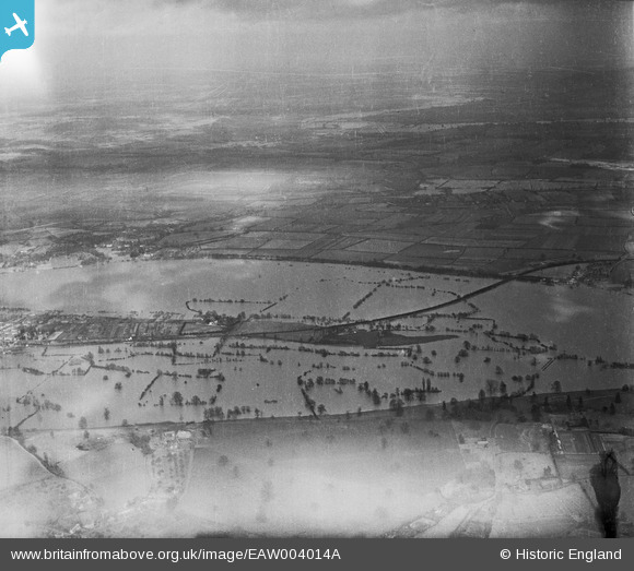
eaw004014a ENGLAND (1947). Flooding along the River Severn around Upper Ham, Upton-upon-Severn, from the south-west, 1947
© Copyright OpenStreetMap contributors and licensed by the OpenStreetMap Foundation. 2024. Cartography is licensed as CC BY-SA.
Details
| Title | [EAW004014A] Flooding along the River Severn around Upper Ham, Upton-upon-Severn, from the south-west, 1947 |
| Reference | EAW004014A |
| Date | 21-March-1947 |
| Link | |
| Place name | UPTON-UPON-SEVERN |
| Parish | UPTON-UPON-SEVERN |
| District | |
| Country | ENGLAND |
| Easting / Northing | 385599, 239396 |
| Longitude / Latitude | -2.2100378963207, 52.052344765642 |
| National Grid Reference | SO856394 |
Pins
 emu-star |
Sunday 18th of May 2014 06:21:25 PM | |
emu-star |
Sunday 18th of May 2014 06:06:43 PM |