
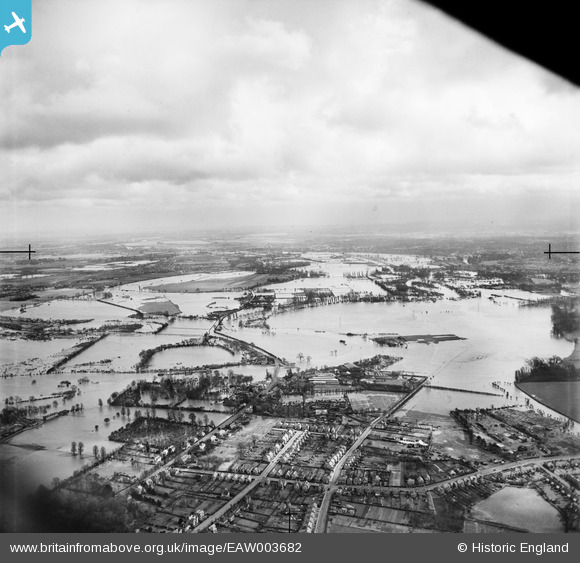
eaw003682 ENGLAND (1947). The River Thames in flood over the Chertsey Meads, Chertsey, from the west, 1947
© Copyright OpenStreetMap contributors and licensed by the OpenStreetMap Foundation. 2026. Cartography is licensed as CC BY-SA.
Nearby Images (2)
EAW003682

EPW049546

Details
| Title | [EAW003682] The River Thames in flood over the Chertsey Meads, Chertsey, from the west, 1947 |
| Reference | EAW003682 |
| Date | 18-March-1947 |
| Link | |
| Place name | CHERTSEY |
| Parish | |
| District | |
| Country | ENGLAND |
| Easting / Northing | 505038, 166586 |
| Longitude / Latitude | -0.49027280291097, 51.38808753739 |
| National Grid Reference | TQ050666 |
Pins

Graham |
Sunday 27th of January 2019 04:22:08 PM | |
|
Katherine Shields |
Thursday 9th of February 2017 09:13:42 PM | |
|
bumblee |
Sunday 12th of July 2015 01:49:18 PM | |
|
Watchbelow |
Thursday 26th of September 2013 12:43:18 PM | |
|
Watchbelow |
Thursday 26th of September 2013 12:41:20 PM | |
now a Co-op! |
Katherine Shields |
Thursday 9th of February 2017 09:14:54 PM |