
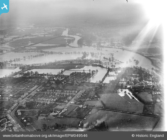
EPW049546 ENGLAND (1936). River Thames in flood around Abbey Mead, Chertsey, from the south, 1936
© Copyright OpenStreetMap contributors and licensed by the OpenStreetMap Foundation. 2026. Cartography is licensed as CC BY-SA.
Nearby Images (3)
EPW049546

EAW003682

EPW049544

Details
| Title | [EPW049546] River Thames in flood around Abbey Mead, Chertsey, from the south, 1936 |
| Reference | EPW049546 |
| Date | January-1936 |
| Link | |
| Place name | CHERTSEY |
| Parish | |
| District | |
| Country | ENGLAND |
| Easting / Northing | 505053, 166490 |
| Longitude / Latitude | -0.49008569514226, 51.387221763009 |
| National Grid Reference | TQ051665 |
Pins
Be the first to add a comment to this image!