
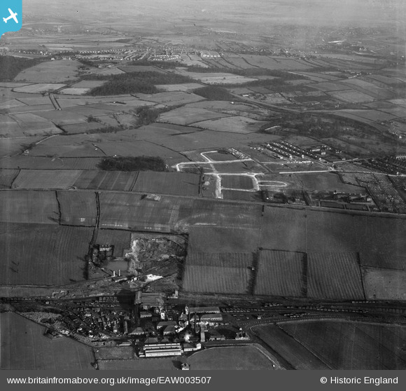
eaw003507 ENGLAND (1947). New Stubbin Colliery, new roads being constructed to the east of Monk Wood and environs, Rawmarsh, from the south-west, 1947
© Copyright OpenStreetMap contributors and licensed by the OpenStreetMap Foundation. 2024. Cartography is licensed as CC BY-SA.
Nearby Images (2)
EAW003507

EAW003493

Details
| Title | [EAW003507] New Stubbin Colliery, new roads being constructed to the east of Monk Wood and environs, Rawmarsh, from the south-west, 1947 |
| Reference | EAW003507 |
| Date | 12-January-1947 |
| Link | |
| Place name | RAWMARSH |
| Parish | |
| District | |
| Country | ENGLAND |
| Easting / Northing | 443133, 396992 |
| Longitude / Latitude | -1.3501735997722, 53.4676447627 |
| National Grid Reference | SK431970 |
