
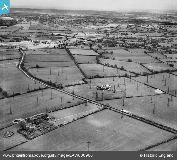
eaw000966 ENGLAND (1946). Dorcas Farm and Radio masts at RAF Stoke Hammond, Stoke Hammond, from the north-west, 1946
© Copyright OpenStreetMap contributors and licensed by the OpenStreetMap Foundation. 2025. Cartography is licensed as CC BY-SA.
Nearby Images (2)
EAW000966

EAW000964

Details
| Title | [EAW000966] Dorcas Farm and Radio masts at RAF Stoke Hammond, Stoke Hammond, from the north-west, 1946 |
| Reference | EAW000966 |
| Date | 28-May-1946 |
| Link | |
| Place name | STOKE HAMMOND |
| Parish | DRAYTON PARSLOW |
| District | |
| Country | ENGLAND |
| Easting / Northing | 486460, 229062 |
| Longitude / Latitude | -0.7417532519784, 51.952888440111 |
| National Grid Reference | SP865291 |
Pins
Be the first to add a comment to this image!