
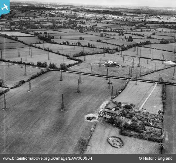
EAW000964 ENGLAND (1946). Dorcas Farm and Radio masts at RAF Stoke Hammond, Stoke Hammond, from the north-west, 1946
© Copyright OpenStreetMap contributors and licensed by the OpenStreetMap Foundation. 2025. Cartography is licensed as CC BY-SA.
Nearby Images (2)
EAW000964

EAW000966

Details
| Title | [EAW000964] Dorcas Farm and Radio masts at RAF Stoke Hammond, Stoke Hammond, from the north-west, 1946 |
| Reference | EAW000964 |
| Date | 28-May-1946 |
| Link | |
| Place name | STOKE HAMMOND |
| Parish | DRAYTON PARSLOW |
| District | |
| Country | ENGLAND |
| Easting / Northing | 486443, 229235 |
| Longitude / Latitude | -0.74195705789276, 51.954446291265 |
| National Grid Reference | SP864292 |
Pins

Sparky |
Friday 10th of November 2017 11:47:15 PM |