
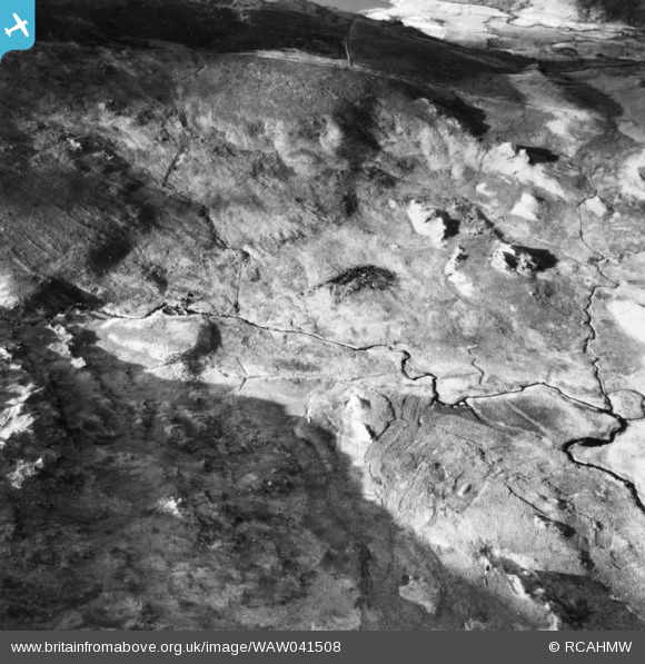
WAW041508 WALES (1952). View of crash site of an Aer Lingus Dakota on 10th January 1952 on the south side of Snowdon, commissioned by the Ministry of Civil Aviation. Oblique aerial photograph, 5½" cut roll film.
© Copyright OpenStreetMap contributors and licensed by the OpenStreetMap Foundation. 2026. Cartography is licensed as CC BY-SA.
Nearby Images (15)
WAW041504

WAW041506

WAW041507

WAW041508

WAW041509

WAW041510

WAW041511

WAW041512

WAW041513

WAW041514

WAW041515

WAW041516

WAW041517

WAW041518

WAW041519

Details
| Title | [WAW041508] View of crash site of an Aer Lingus Dakota on 10th January 1952 on the south side of Snowdon, commissioned by the Ministry of Civil Aviation. Oblique aerial photograph, 5½" cut roll film. |
| Reference | WAW041508 |
| Date | 1952 |
| Link | Coflein Archive Item 6423495 |
| Place name | |
| Parish | |
| District | |
| Country | WALES |
| Easting / Northing | 266950, 352349 |
| Longitude / Latitude | -3.9852194337783, 53.051515886941 |
| National Grid Reference | SH670523 |
Pins
User Comment Contributions
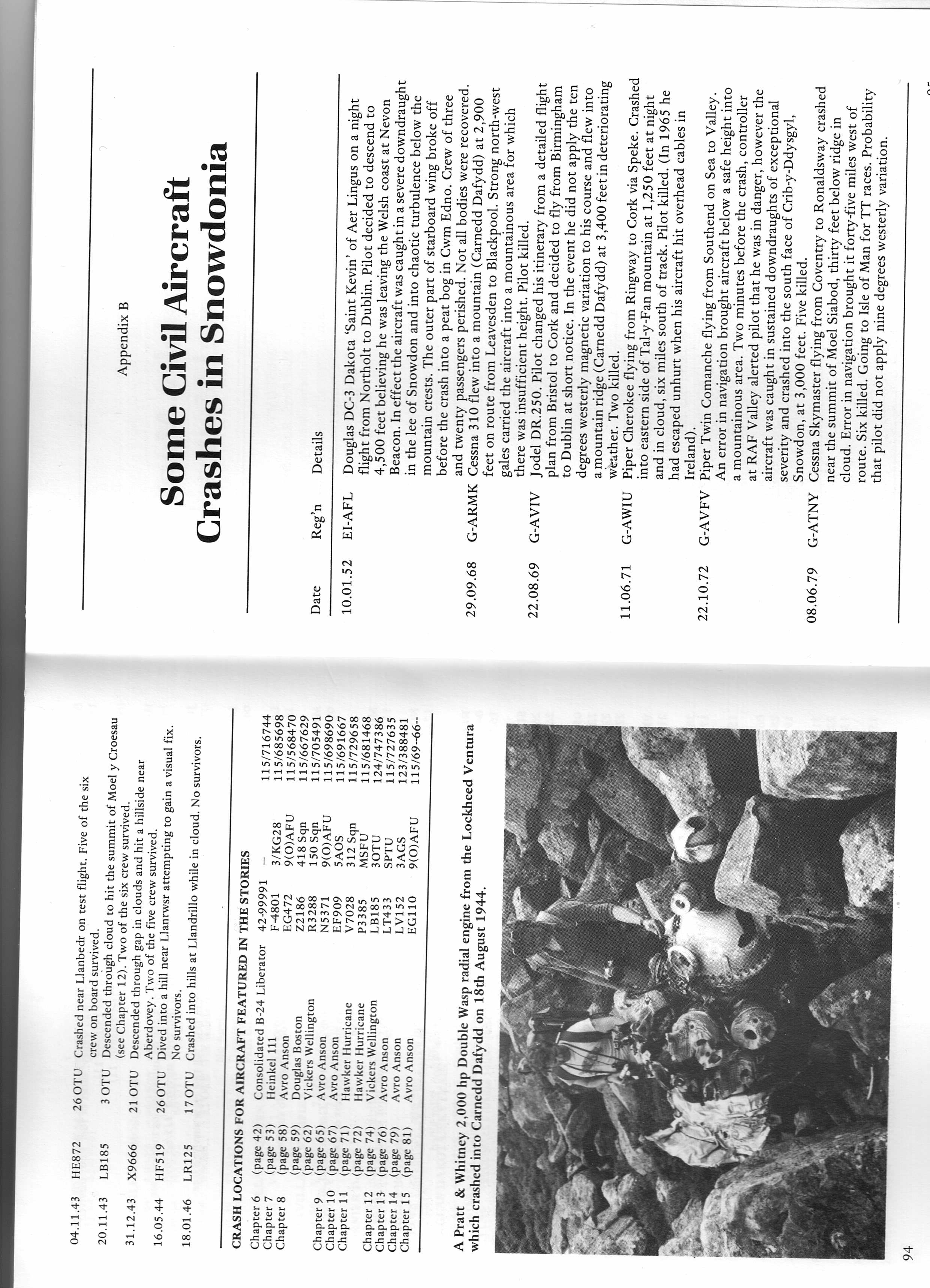
See the attached copy of pages 94 and 95 from No Landing Place by Edward Doylerush Midland Counties Publications 1985 ISBN0 904597 57 1 This gives further details of this aircraft which went down on 10.01.52 |

Class31 |
Wednesday 6th of May 2015 10:41:15 AM |
View is of Cwm Edno looking west at approximately grid SH6752 |
Class31 |
Wednesday 6th of May 2015 10:07:10 AM |