
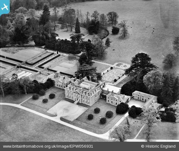
EPW056931 ENGLAND (1938). Beechwood House, Flamstead, 1938
© Copyright OpenStreetMap contributors and licensed by the OpenStreetMap Foundation. 2025. Cartography is licensed as CC BY-SA.
Nearby Images (2)
EPW056931

EPW056932

Details
| Title | [EPW056931] Beechwood House, Flamstead, 1938 |
| Reference | EPW056931 |
| Date | 26-April-1938 |
| Link | |
| Place name | FLAMSTEAD |
| Parish | FLAMSTEAD |
| District | |
| Country | ENGLAND |
| Easting / Northing | 504517, 214435 |
| Longitude / Latitude | -0.48349414636711, 51.818309203019 |
| National Grid Reference | TL045144 |
Pins
 |

Bluid |
Saturday 22nd of August 2020 09:14:21 AM |
 |
Bluid |
Saturday 22nd of August 2020 08:45:51 AM |
|
Bluid |
Friday 2nd of May 2014 11:04:10 AM |
User Comment Contributions
Beechwood Park School here indexed as Flamstead, now recognised as Markyate |
Bluid |
Friday 2nd of May 2014 11:06:42 AM |