
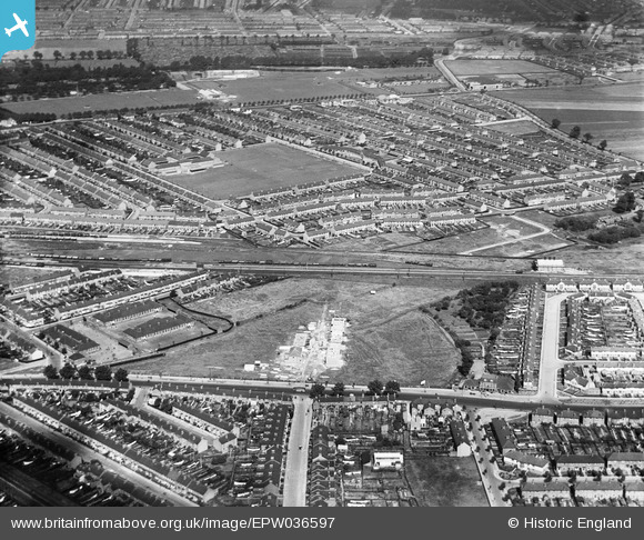
EPW036597 ENGLAND (1931). Lancaster Avenue under construction and housing surrounding Eastbury Comprehensive School, Barking, from the south, 1931
© Copyright OpenStreetMap contributors and licensed by the OpenStreetMap Foundation. 2025. Cartography is licensed as CC BY-SA.
Nearby Images (2)
EPW036597

EPW006562

Details
| Title | [EPW036597] Lancaster Avenue under construction and housing surrounding Eastbury Comprehensive School, Barking, from the south, 1931 |
| Reference | EPW036597 |
| Date | September-1931 |
| Link | |
| Place name | BARKING |
| Parish | |
| District | |
| Country | ENGLAND |
| Easting / Northing | 545299, 183933 |
| Longitude / Latitude | 0.095177052429721, 51.535097318186 |
| National Grid Reference | TQ453839 |
Pins

JewlseyB |
Saturday 20th of June 2015 10:57:06 PM | |
|
JewlseyB |
Saturday 20th of June 2015 10:52:38 PM | |
|
JewlseyB |
Saturday 20th of June 2015 10:49:12 PM | |
|
JewlseyB |
Saturday 20th of June 2015 10:40:21 PM | |
|
JewlseyB |
Saturday 20th of June 2015 10:35:50 PM | |
|
JewlseyB |
Saturday 20th of June 2015 10:30:08 PM |