
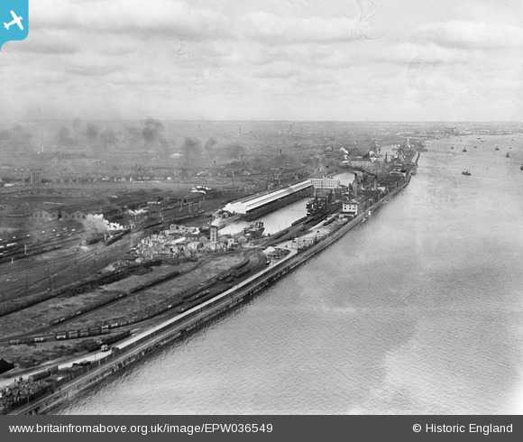
EPW036549 ENGLAND (1931). St Andrew's Dock and the River Humber, Kingston upon Hull, from the south-west, 1931
© Copyright OpenStreetMap contributors and licensed by the OpenStreetMap Foundation. 2025. Cartography is licensed as CC BY-SA.
Nearby Images (4)
EPW036549

EPW036385

EPW010810

EPW010809

Details
| Title | [EPW036549] St Andrew's Dock and the River Humber, Kingston upon Hull, from the south-west, 1931 |
| Reference | EPW036549 |
| Date | August-1931 |
| Link | |
| Place name | KINGSTON UPON HULL |
| Parish | |
| District | |
| Country | ENGLAND |
| Easting / Northing | 506711, 426523 |
| Longitude / Latitude | -0.38251598426107, 53.723958114722 |
| National Grid Reference | TA067265 |
Pins
 John Wass |
Friday 28th of November 2014 11:46:02 AM |