
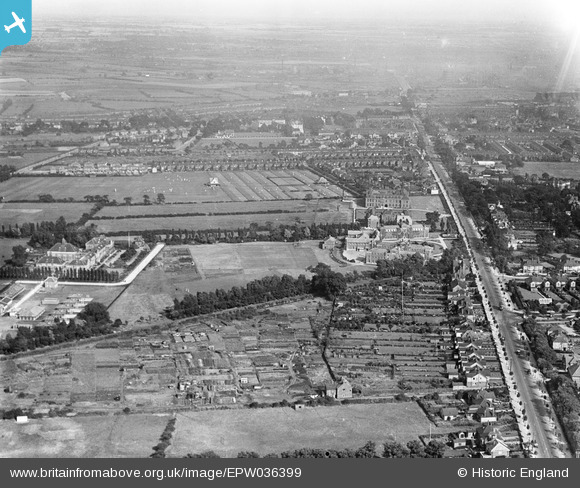
EPW036399 ENGLAND (1931). The City of Hull Municipal Training College, Newland School for Girls and environs, Kingston upon Hull, from the west, 1931
© Copyright OpenStreetMap contributors and licensed by the OpenStreetMap Foundation. 2025. Cartography is licensed as CC BY-SA.
Nearby Images (3)
EPW036399

EPW036401

EPW036513

Details
| Title | [EPW036399] The City of Hull Municipal Training College, Newland School for Girls and environs, Kingston upon Hull, from the west, 1931 |
| Reference | EPW036399 |
| Date | August-1931 |
| Link | |
| Place name | KINGSTON UPON HULL |
| Parish | |
| District | |
| Country | ENGLAND |
| Easting / Northing | 507265, 431715 |
| Longitude / Latitude | -0.37231979979387, 53.770497024581 |
| National Grid Reference | TA073317 |
Pins
 John Wass |
Tuesday 26th of May 2015 08:10:03 PM | |
John Wass |
Tuesday 26th of May 2015 08:09:26 PM | |
John Wass |
Tuesday 26th of May 2015 08:09:25 PM | |
John Wass |
Friday 24th of April 2015 11:00:43 AM | |
Stu.B |
Friday 14th of June 2013 08:21:00 PM |