
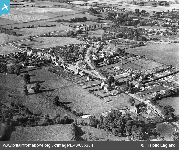
EPW036364 ENGLAND (1931). Poppy Road and environs, Princes Risborough, 1931
© Copyright OpenStreetMap contributors and licensed by the OpenStreetMap Foundation. 2025. Cartography is licensed as CC BY-SA.
Nearby Images (2)
EPW036364

EAW049101

Details
| Title | [EPW036364] Poppy Road and environs, Princes Risborough, 1931 |
| Reference | EPW036364 |
| Date | August-1931 |
| Link | |
| Place name | PRINCES RISBOROUGH |
| Parish | PRINCES RISBOROUGH |
| District | |
| Country | ENGLAND |
| Easting / Northing | 480451, 202672 |
| Longitude / Latitude | -0.83531895585839, 51.716540982268 |
| National Grid Reference | SP805027 |
