
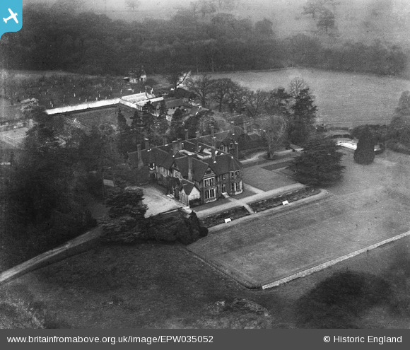
EPW035052 ENGLAND (1931). Hawkwell Place, Pembury, 1931
© Copyright OpenStreetMap contributors and licensed by the OpenStreetMap Foundation. 2025. Cartography is licensed as CC BY-SA.
Nearby Images (2)
EPW035052

EPW035051

Details
| Title | [EPW035052] Hawkwell Place, Pembury, 1931 |
| Reference | EPW035052 |
| Date | April-1931 |
| Link | |
| Place name | PEMBURY |
| Parish | PEMBURY |
| District | |
| Country | ENGLAND |
| Easting / Northing | 562694, 143002 |
| Longitude / Latitude | 0.32708233655335, 51.162576367404 |
| National Grid Reference | TQ627430 |
Pins
Be the first to add a comment to this image!