
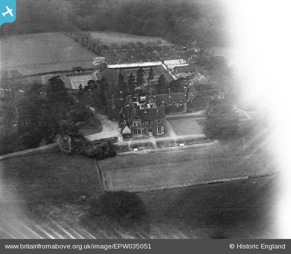
EPW035051 ENGLAND (1931). Hawkwell Place, Pembury, 1931. This image has been affected by flare.
© Copyright OpenStreetMap contributors and licensed by the OpenStreetMap Foundation. 2025. Cartography is licensed as CC BY-SA.
Nearby Images (2)
EPW035051

EPW035052

Details
| Title | [EPW035051] Hawkwell Place, Pembury, 1931. This image has been affected by flare. |
| Reference | EPW035051 |
| Date | April-1931 |
| Link | |
| Place name | PEMBURY |
| Parish | PEMBURY |
| District | |
| Country | ENGLAND |
| Easting / Northing | 562698, 143005 |
| Longitude / Latitude | 0.32714085680778, 51.16260218648 |
| National Grid Reference | TQ627430 |
Pins
Be the first to add a comment to this image!