
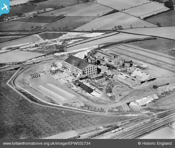
EPW031734 ENGLAND (1930). The United Sugar Co Sugar Beet Factory, Bury St Edmunds, 1930
© Copyright OpenStreetMap contributors and licensed by the OpenStreetMap Foundation. 2025. Cartography is licensed as CC BY-SA.
Nearby Images (8)
EPW031734

EPW031739

EPW031736

EPW031738

EPW031737

EPW031733

EPW031735

EPW031740

Details
| Title | [EPW031734] The United Sugar Co Sugar Beet Factory, Bury St Edmunds, 1930 |
| Reference | EPW031734 |
| Date | April-1930 |
| Link | |
| Place name | BURY ST EDMUNDS |
| Parish | BURY ST. EDMUNDS |
| District | |
| Country | ENGLAND |
| Easting / Northing | 586117, 265382 |
| Longitude / Latitude | 0.72709805210071, 52.254682761804 |
| National Grid Reference | TL861654 |
Pins
 MB |
Friday 5th of February 2021 07:19:15 PM |