
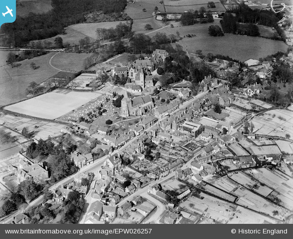
EPW026257 ENGLAND (1929). The High Street, St Dunstan's Church and the Old Palace (The Convent of the Holy Child Jesus, St Leonard's Mayfield School), Mayfield, 1929
© Copyright OpenStreetMap contributors and licensed by the OpenStreetMap Foundation. 2025. Cartography is licensed as CC BY-SA.
Nearby Images (4)
EPW026257
, Mayfield, 1929")
EPW026254

EPW026258
, Mayfield, 1929")
EPW026255

Details
| Title | [EPW026257] The High Street, St Dunstan's Church and the Old Palace (The Convent of the Holy Child Jesus, St Leonard's Mayfield School), Mayfield, 1929 |
| Reference | EPW026257 |
| Date | 25-April-1929 |
| Link | |
| Place name | MAYFIELD |
| Parish | MAYFIELD AND FIVE ASHES |
| District | |
| Country | ENGLAND |
| Easting / Northing | 558649, 127016 |
| Longitude / Latitude | 0.26225099025057, 51.020060862456 |
| National Grid Reference | TQ586270 |
Pins
Be the first to add a comment to this image!