
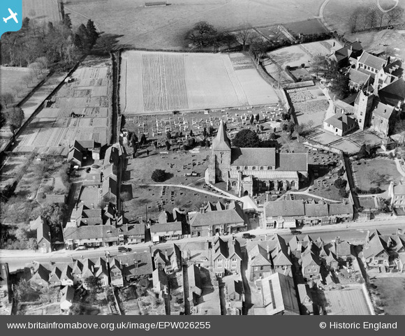
EPW026255 ENGLAND (1929). St Dunstan's Church, Mayfield, 1929
© Copyright OpenStreetMap contributors and licensed by the OpenStreetMap Foundation. 2025. Cartography is licensed as CC BY-SA.
Nearby Images (4)
EPW026255

EPW026258
, Mayfield, 1929")
EPW026254

EPW026257
, Mayfield, 1929")
Details
| Title | [EPW026255] St Dunstan's Church, Mayfield, 1929 |
| Reference | EPW026255 |
| Date | 25-April-1929 |
| Link | |
| Place name | MAYFIELD |
| Parish | MAYFIELD AND FIVE ASHES |
| District | |
| Country | ENGLAND |
| Easting / Northing | 558613, 127052 |
| Longitude / Latitude | 0.26175382510127, 51.020394300288 |
| National Grid Reference | TQ586271 |
Pins

David960 |
Monday 9th of March 2015 10:55:52 PM | |
|
David960 |
Monday 9th of March 2015 10:53:07 PM | |
|
David960 |
Monday 9th of March 2015 10:50:53 PM | |
|
David960 |
Monday 9th of March 2015 10:49:57 PM | |
|
David960 |
Monday 9th of March 2015 10:48:07 PM | |
|
David960 |
Monday 9th of March 2015 10:47:11 PM |