
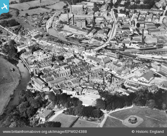
EPW024388 ENGLAND (1928). The town centre, Bingley, 1928. This image has been produced from a copy-negative.
© Copyright OpenStreetMap contributors and licensed by the OpenStreetMap Foundation. 2025. Cartography is licensed as CC BY-SA.
Nearby Images (8)
EPW024388

EAW033061

EAW033064

EAW033065

EAW033054

EAW033058

EAW033056

EAW033057

Details
| Title | [EPW024388] The town centre, Bingley, 1928. This image has been produced from a copy-negative. |
| Reference | EPW024388 |
| Date | September-1928 |
| Link | |
| Place name | BINGLEY |
| Parish | |
| District | |
| Country | ENGLAND |
| Easting / Northing | 410712, 439127 |
| Longitude / Latitude | -1.8371581891275, 53.848061998909 |
| National Grid Reference | SE107391 |
Pins
 John W |
Sunday 4th of September 2016 11:41:40 PM | |
John W |
Sunday 4th of September 2016 11:40:40 PM | |
H.J.Hill |
Wednesday 4th of March 2015 10:59:49 AM | |
Yep. I remember getting my first Airfix kit in there :) |
ajbinoz |
Monday 20th of March 2017 06:53:47 AM |
H.J.Hill |
Wednesday 4th of March 2015 10:57:17 AM | |
Skylon |
Sunday 14th of December 2014 06:26:38 PM | |
Skylon |
Sunday 14th of December 2014 06:09:58 PM |