
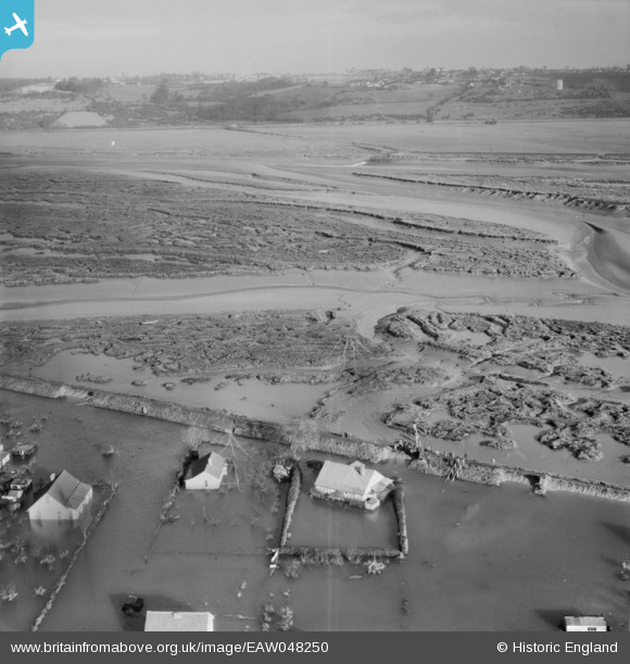
EAW048250 ENGLAND (1953). Tewkes Creek Marshes and damaged flood defences at Sunken Marsh, Canvey Island, from the south, 1953
© Copyright OpenStreetMap contributors and licensed by the OpenStreetMap Foundation. 2025. Cartography is licensed as CC BY-SA.
Nearby Images (6)
EAW048250

EAW048241

EAW048244

EAW048246

EAW048249

EAW048242

Details
| Title | [EAW048250] Tewkes Creek Marshes and damaged flood defences at Sunken Marsh, Canvey Island, from the south, 1953 |
| Reference | EAW048250 |
| Date | 2-February-1953 |
| Link | |
| Place name | CANVEY ISLAND |
| Parish | CANVEY ISLAND |
| District | |
| Country | ENGLAND |
| Easting / Northing | 580761, 184341 |
| Longitude / Latitude | 0.60622675221239, 51.528522347353 |
| National Grid Reference | TQ808843 |
Pins
Be the first to add a comment to this image!