
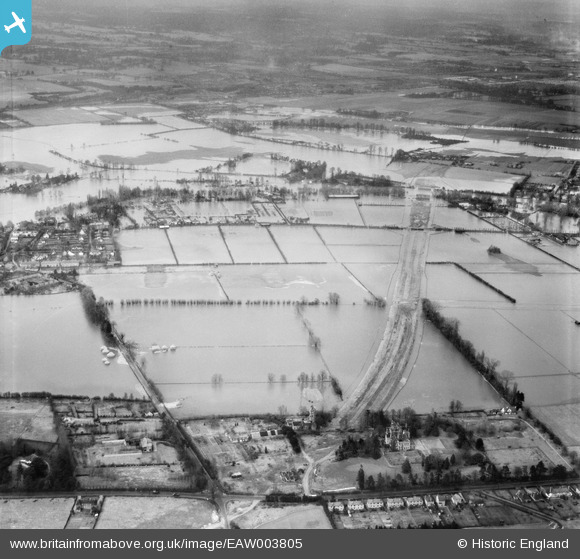
EAW003805 ENGLAND (1947). Flooding to the north of the Bray Court Hotel at the site of the M4 Motorway, Bray, 1947
© Copyright OpenStreetMap contributors and licensed by the OpenStreetMap Foundation. 2025. Cartography is licensed as CC BY-SA.
Nearby Images (7)
EAW003805

EPW052031

EPW052026

EPW052028

EAW003806

EAW003803

EPW052022

Details
| Title | [EAW003805] Flooding to the north of the Bray Court Hotel at the site of the M4 Motorway, Bray, 1947 |
| Reference | EAW003805 |
| Date | 19-March-1947 |
| Link | |
| Place name | BRAY |
| Parish | BRAY |
| District | |
| Country | ENGLAND |
| Easting / Northing | 490635, 179210 |
| Longitude / Latitude | -0.6939930115274, 51.504064310626 |
| National Grid Reference | SU906792 |
Pins

Steve |
Tuesday 18th of February 2014 03:15:50 AM | |
|
Steve |
Tuesday 18th of February 2014 03:13:48 AM | |
|
Steve |
Tuesday 18th of February 2014 03:06:28 AM | |
|
Steve |
Tuesday 18th of February 2014 03:00:05 AM | |
|
Steve |
Tuesday 18th of February 2014 02:59:00 AM |