
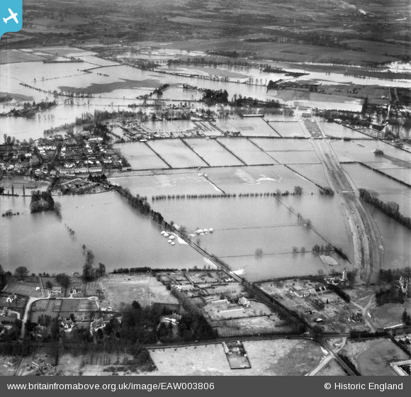
EAW003806 ENGLAND (1947). Flooding around The Cut at the site of the M4 Motorway, Bray, 1947
© Copyright OpenStreetMap contributors and licensed by the OpenStreetMap Foundation. 2026. Cartography is licensed as CC BY-SA.
Nearby Images (5)
EAW003806

EAW003805

EPW052022

EPW052031

EPW052030

Details
| Title | [EAW003806] Flooding around The Cut at the site of the M4 Motorway, Bray, 1947 |
| Reference | EAW003806 |
| Date | 19-March-1947 |
| Link | |
| Place name | BRAY |
| Parish | BRAY |
| District | |
| Country | ENGLAND |
| Easting / Northing | 490421, 179157 |
| Longitude / Latitude | -0.69708938112448, 51.503622118915 |
| National Grid Reference | SU904792 |
Pins
Be the first to add a comment to this image!