
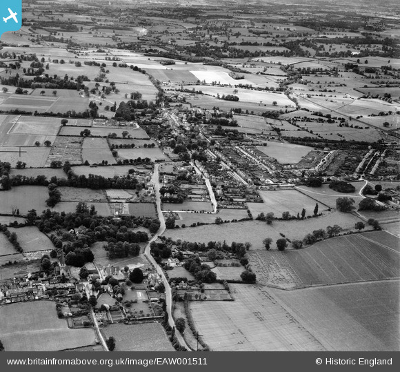
EAW001511 ENGLAND (1946). Old Harlow and Churchgate Street, Harlow, from the east, 1946
© Copyright OpenStreetMap contributors and licensed by the OpenStreetMap Foundation. 2025. Cartography is licensed as CC BY-SA.
Nearby Images (2)
EAW001511

EAW001512

Details
| Title | [EAW001511] Old Harlow and Churchgate Street, Harlow, from the east, 1946 |
| Reference | EAW001511 |
| Date | 5-July-1946 |
| Link | |
| Place name | HARLOW |
| Parish | |
| District | |
| Country | ENGLAND |
| Easting / Northing | 548154, 211666 |
| Longitude / Latitude | 0.14807072925803, 51.78356316264 |
| National Grid Reference | TL482117 |
Pins
 oliver lee |
Wednesday 29th of June 2022 09:24:57 PM | |
Sparky |
Saturday 23rd of September 2017 10:29:50 AM | |
Sparky |
Saturday 23rd of September 2017 10:29:50 AM |