
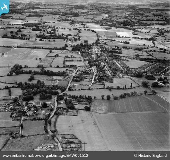
EAW001512 ENGLAND (1946). Old Harlow and Churchgate Street, Harlow, from the east, 1946
© Copyright OpenStreetMap contributors and licensed by the OpenStreetMap Foundation. 2025. Cartography is licensed as CC BY-SA.
Nearby Images (2)
EAW001512

EAW001511

Details
| Title | [EAW001512] Old Harlow and Churchgate Street, Harlow, from the east, 1946 |
| Reference | EAW001512 |
| Date | 5-July-1946 |
| Link | |
| Place name | HARLOW |
| Parish | |
| District | |
| Country | ENGLAND |
| Easting / Northing | 548244, 211764 |
| Longitude / Latitude | 0.14941650842868, 51.784419925145 |
| National Grid Reference | TL482118 |
Pins
Be the first to add a comment to this image!