
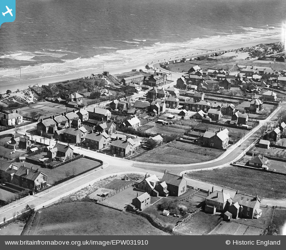
epw031910 ENGLAND (1930). The Park Road and Trusthorpe Road area, Sutton on Sea, 1930
© Copyright OpenStreetMap contributors and licensed by the OpenStreetMap Foundation. 2026. Cartography is licensed as CC BY-SA.
Nearby Images (3)
EPW031910

EPW031894

EPW031895

Details
| Title | [EPW031910] The Park Road and Trusthorpe Road area, Sutton on Sea, 1930 |
| Reference | EPW031910 |
| Date | May-1930 |
| Link | |
| Place name | SUTTON ON SEA |
| Parish | MABLETHORPE AND SUTTON |
| District | |
| Country | ENGLAND |
| Easting / Northing | 552047, 382287 |
| Longitude / Latitude | 0.28268382712663, 53.315379255015 |
| National Grid Reference | TF520823 |
