
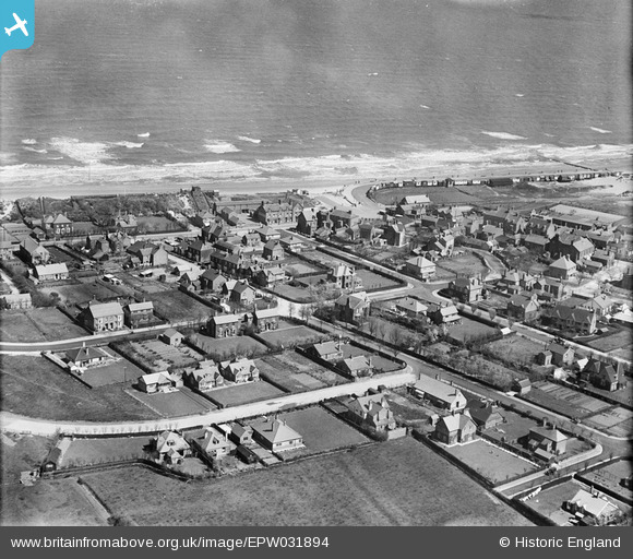
EPW031894 ENGLAND (1930). The village and the sea, Sutton on Sea, 1930
© Copyright OpenStreetMap contributors and licensed by the OpenStreetMap Foundation. 2026. Cartography is licensed as CC BY-SA.
Nearby Images (4)
EPW031894

EPW031910

EPW031895

EPW031891

Details
| Title | [EPW031894] The village and the sea, Sutton on Sea, 1930 |
| Reference | EPW031894 |
| Date | May-1930 |
| Link | |
| Place name | SUTTON ON SEA |
| Parish | MABLETHORPE AND SUTTON |
| District | |
| Country | ENGLAND |
| Easting / Northing | 552065, 382184 |
| Longitude / Latitude | 0.28290443396097, 53.314448878392 |
| National Grid Reference | TF521822 |
Pins
Be the first to add a comment to this image!