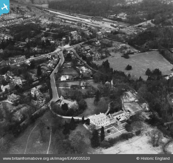
eaw035520 ENGLAND (1951). St Peter's Junior School, Farnborough Road and environs, Farnborough Park, 1951. This image has been produced from a print.
© Copyright OpenStreetMap contributors and licensed by the OpenStreetMap Foundation. 2024. Cartography is licensed as CC BY-SA.
Nearby Images (5)
Details
| Title | [EAW035520] St Peter's Junior School, Farnborough Road and environs, Farnborough Park, 1951. This image has been produced from a print. |
| Reference | EAW035520 |
| Date | 19-April-1951 |
| Link | |
| Place name | FARNBOROUGH PARK |
| Parish | |
| District | |
| Country | ENGLAND |
| Easting / Northing | 487205, 155679 |
| Longitude / Latitude | -0.74918898003902, 51.293048479514 |
| National Grid Reference | SU872557 |
Pins
 Sweet Pete |
Sunday 1st of February 2015 03:21:29 PM | |
 Sweet Pete |
Sunday 1st of February 2015 03:20:22 PM | |
 Sweet Pete |
Sunday 1st of February 2015 03:19:27 PM | |
 Sweet Pete |
Sunday 1st of February 2015 03:17:21 PM | |
 Sweet Pete |
Sunday 1st of February 2015 03:17:18 PM |


![[EAW035520] St Peter's Junior School, Farnborough Road and environs, Farnborough Park, 1951. This image has been produced from a print.](http://britainfromabove.org.uk/sites/all/libraries/aerofilms-images/public/100x100/EAW/035/EAW035520.jpg)
![[EAW035524] St Peter's Junior School, Farnborough Road and environs, Farnborough Park, 1951. This image has been produced from a print.](http://britainfromabove.org.uk/sites/all/libraries/aerofilms-images/public/100x100/EAW/035/EAW035524.jpg)
![[EAW035522] St Peter's Junior School, Farnborough Road and environs, Farnborough Park, from the south-east, 1951. This image has been produced from a print.](http://britainfromabove.org.uk/sites/all/libraries/aerofilms-images/public/100x100/EAW/035/EAW035522.jpg)
![[EAW035527] St Peter's Junior School, Farnborough Park, 1951. This image has been produced from a print.](http://britainfromabove.org.uk/sites/all/libraries/aerofilms-images/public/100x100/EAW/035/EAW035527.jpg)
![[EAW035521] St Peter's Junior School, Farnborough Road and environs, Farnborough Park, from the south-east, 1951. This image has been produced from a print.](http://britainfromabove.org.uk/sites/all/libraries/aerofilms-images/public/100x100/EAW/035/EAW035521.jpg)