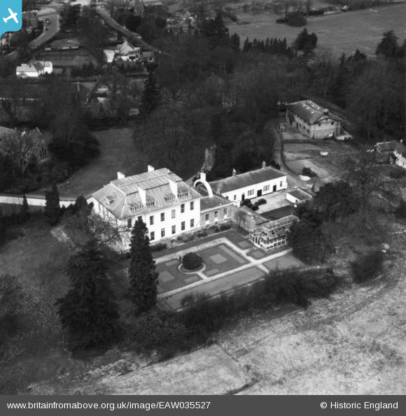
EAW035527 ENGLAND (1951). St Peter's Junior School, Farnborough Park, 1951. This image has been produced from a print.
© Copyright OpenStreetMap contributors and licensed by the OpenStreetMap Foundation. 2024. Cartography is licensed as CC BY-SA.
Nearby Images (5)
Details
| Title | [EAW035527] St Peter's Junior School, Farnborough Park, 1951. This image has been produced from a print. |
| Reference | EAW035527 |
| Date | 19-April-1951 |
| Link | |
| Place name | FARNBOROUGH PARK |
| Parish | |
| District | |
| Country | ENGLAND |
| Easting / Northing | 487353, 155589 |
| Longitude / Latitude | -0.74708873603169, 51.292216627933 |
| National Grid Reference | SU874556 |
Pins
Be the first to add a comment to this image!


![[EAW035527] St Peter's Junior School, Farnborough Park, 1951. This image has been produced from a print.](http://britainfromabove.org.uk/sites/all/libraries/aerofilms-images/public/100x100/EAW/035/EAW035527.jpg)
![[EAW035522] St Peter's Junior School, Farnborough Road and environs, Farnborough Park, from the south-east, 1951. This image has been produced from a print.](http://britainfromabove.org.uk/sites/all/libraries/aerofilms-images/public/100x100/EAW/035/EAW035522.jpg)
![[EAW035521] St Peter's Junior School, Farnborough Road and environs, Farnborough Park, from the south-east, 1951. This image has been produced from a print.](http://britainfromabove.org.uk/sites/all/libraries/aerofilms-images/public/100x100/EAW/035/EAW035521.jpg)
![[EAW035520] St Peter's Junior School, Farnborough Road and environs, Farnborough Park, 1951. This image has been produced from a print.](http://britainfromabove.org.uk/sites/all/libraries/aerofilms-images/public/100x100/EAW/035/EAW035520.jpg)
![[EAW035524] St Peter's Junior School, Farnborough Road and environs, Farnborough Park, 1951. This image has been produced from a print.](http://britainfromabove.org.uk/sites/all/libraries/aerofilms-images/public/100x100/EAW/035/EAW035524.jpg)