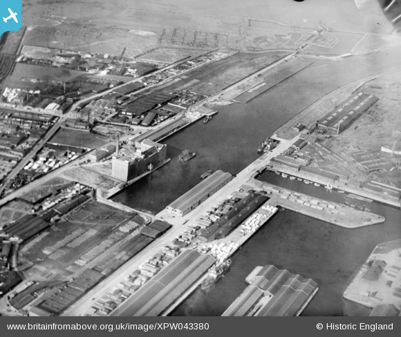
XPW043380 NORTHERN IRELAND (1933). Belfast Harbour Commissioners, Belfast, Belfast, Northern Ireland, 1933. Oblique aerial photograph taken facing North.
© Copyright OpenStreetMap contributors and licensed by the OpenStreetMap Foundation. 2026. Cartography is licensed as CC BY-SA.
Nearby Images (6)
Details
| Title | [XPW043380] Belfast Harbour Commissioners, Belfast, Belfast, Northern Ireland, 1933. Oblique aerial photograph taken facing North. |
| Reference | XPW043380 |
| Date | 1933 |
| Link | |
| Place name | BELFAST |
| Parish | NORTHERN IRELAND |
| District | |
| Country | NORTHERN IRELAND |
| Easting / Northing | 147490, 531453 |
| Longitude / Latitude | -5.912433, 54.614905 |
| National Grid Reference |
Pins

MB |
Monday 26th of September 2016 09:17:29 AM | |

MB |
Monday 26th of September 2016 09:15:59 AM | |

MB |
Monday 26th of September 2016 09:11:28 AM |


![[XPW043380] Belfast Harbour Commissioners, Belfast, Belfast, Northern Ireland, 1933. Oblique aerial photograph taken facing North.](http://britainfromabove.org.uk/sites/all/libraries/aerofilms-images/public/100x100/XPW/043/XPW043380.jpg)
![[XPW043381] Belfast Harbour Commissioners, Belfast, Belfast, Northern Ireland, 1933. Oblique aerial photograph taken facing North.](http://britainfromabove.org.uk/sites/all/libraries/aerofilms-images/public/100x100/XPW/043/XPW043381.jpg)
![[XPW043383] Belfast Harbour Commissioners, Belfast, Belfast, Northern Ireland, 1933. Oblique aerial photograph taken facing North.](http://britainfromabove.org.uk/sites/all/libraries/aerofilms-images/public/100x100/XPW/043/XPW043383.jpg)
![[EAW511323] Tower Bridge and HMS Belfast, London, 1986](http://britainfromabove.org.uk/sites/all/libraries/aerofilms-images/public/100x100/EAW/511/EAW511323.jpg)
![[XPW043382] Belfast Harbour Commissioners, Belfast, Belfast, Northern Ireland, 1933. Oblique aerial photograph taken facing East.](http://britainfromabove.org.uk/sites/all/libraries/aerofilms-images/public/100x100/XPW/043/XPW043382.jpg)
![[XPW043385] Belfast Harbour Commissioners, Belfast, Belfast, Northern Ireland, 1933. Oblique aerial photograph taken facing East.](http://britainfromabove.org.uk/sites/all/libraries/aerofilms-images/public/100x100/XPW/043/XPW043385.jpg)